Lesotho Land Cover Assessment
FAO and the Government of Lesotho (through CEDAMA, Committee on Environmental Data Management) have developed Land Cover Database and Atlas for Lesotho. map and a Land Cover Change assessment.
The Lesotho Land Cover Database is based on integral use of innovative geospatial technology to respond to the needs of the country related to: land cover and its change assessment, land degradation and erosion analysis, agriculture monitoring, area frame and statistics, etc.
FAO provided technical assistance as the executing agency in close cooperation with all national parties. The immediate benefits are the provision of improved, timely and reliable information for decision making in the Ministry of Agriculture and Food Security (MAFS); Land Administration Authority (LAA); Ministry of Forestry and Land Reclamation (MFLR); Bureau of Statistics (BOS) and other national and multilateral organizations engaged in agricultural rehabilitation, poverty alleviation and food security programmes.
The ultimate beneficiaries are the Basotho people, in particular the rural people which suffer from significant food insecurity. They will benefit from better targeted programmes and policies to rehabilitate and further develop the agricultural sector, hence reduce poverty and vulnerability to food insecurity. Through the provision of better information, short-term emergency assistance needs, and also longer-term rehabilitation and development needs will be fulfilled more efficiently and effectively, ultimately reducing food insecurity, vulnerability and poverty.
The Lesotho Land Cover initiative is supported financially by the European Commission Humanitarian Aid and Civil Protection department (ECHO) and the Swiss Development Cooperation (SDC).
Detailed information is available in this leaflet.
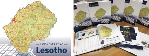
Download the Lesotho Land Cover Atlas here.
The Lesotho Land Cover Database is based on integral use of innovative geospatial technology to respond to the needs of the country related to: land cover and its change assessment, land degradation and erosion analysis, agriculture monitoring, area frame and statistics, etc.
FAO provided technical assistance as the executing agency in close cooperation with all national parties. The immediate benefits are the provision of improved, timely and reliable information for decision making in the Ministry of Agriculture and Food Security (MAFS); Land Administration Authority (LAA); Ministry of Forestry and Land Reclamation (MFLR); Bureau of Statistics (BOS) and other national and multilateral organizations engaged in agricultural rehabilitation, poverty alleviation and food security programmes.
The ultimate beneficiaries are the Basotho people, in particular the rural people which suffer from significant food insecurity. They will benefit from better targeted programmes and policies to rehabilitate and further develop the agricultural sector, hence reduce poverty and vulnerability to food insecurity. Through the provision of better information, short-term emergency assistance needs, and also longer-term rehabilitation and development needs will be fulfilled more efficiently and effectively, ultimately reducing food insecurity, vulnerability and poverty.
The Lesotho Land Cover initiative is supported financially by the European Commission Humanitarian Aid and Civil Protection department (ECHO) and the Swiss Development Cooperation (SDC).
Detailed information is available in this leaflet.
Download the Lesotho Land Cover Atlas here.

|
|